Woodbridge advances $8 million business district project, but questions remain about return on investment
Thirteen months after an initial public presentation, plans are more detailed — but the Town has yet to estimate how its infrastructure investments could expand Woodbridge's commercial tax base

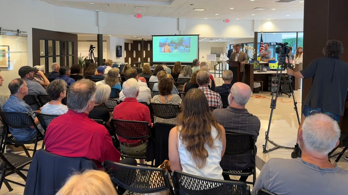
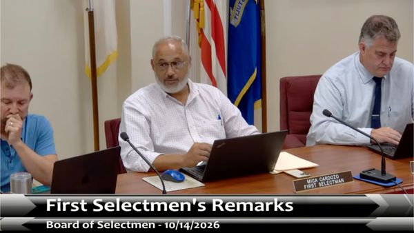
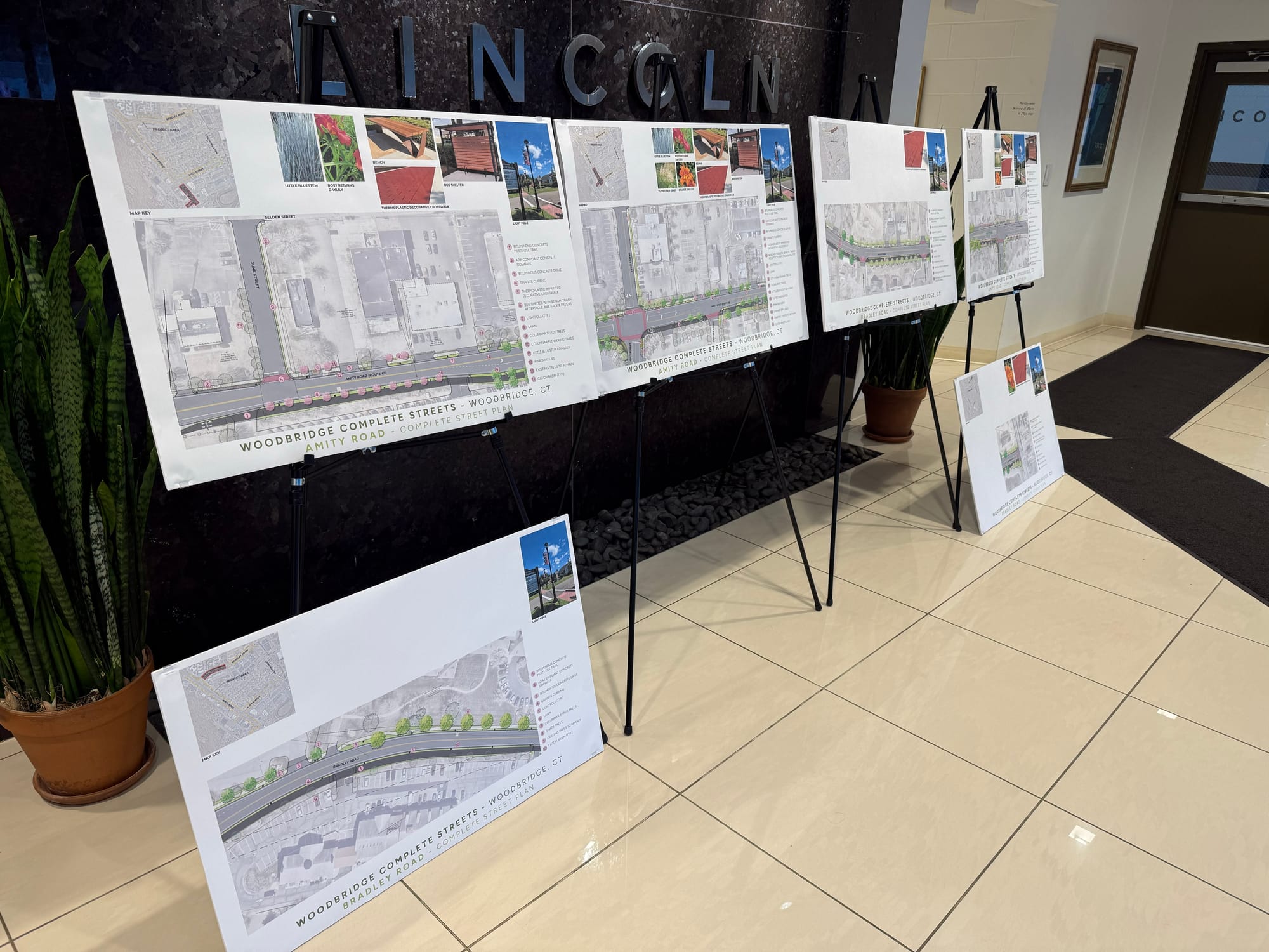
Approximately 60 people, including Town officials, consultants, business owners, residents and other participants, gathered at Crest Lincoln of Woodbridge for the July 29 presentation on the Woodbridge Business District Connectivity Project. Crest management team member Peter Palumbo welcomed attendees and introduced Economic Development Commission Chairman Cliff Lynch, who thanked the Crest team for once again hosting the event before turning the presentation over to First Selectman Mica Cardozo.
More than a year after residents and business owners first reviewed preliminary plans for improving Woodbridge’s business district, the evening's presentation highlighted the project’s evolution from approximately 30 percent to 60 percent design through a more detailed proposal, revisions prompted by public comments, and a clearer explanation of how the project fits within the Town’s long-term economic development strategy. The updated design includes reconstructed sidewalks, a multi-use trail, pedestrian lighting, landscaped streetscapes, bus shelters, new crosswalks and roadway changes intended to improve safety while creating a more attractive commercial corridor.
To help readers understand what has changed — and what questions have yet to be answered — the Woodbridge Town Chronicle compared presentations on the project made in June 2025 and July 2026. The comparison shows how the proposal has evolved over the past 13 months as it advances toward final design, revealing a project that has progressed from conceptual planning to detailed design while shifting the public discussion from planning concepts to implementation issues — and directing attention from engineering questions toward broader questions about the project’s long-term economic impact.
Project background
In August 2024, the Connecticut Department of Transportation (DOT) awarded the Town of Woodbridge a $7,874,400 grant through the state’s Local Transportation Capital Improvement Program (LOTCIP) Complete Streets Program to improve the Amity Road, Lucy Street and Bradley Road corridor. According to the Town’s 2025 Annual Comprehensive Financial Report, the project would reconfigure the public right-of-way to emphasize pedestrian safety and non-motorized transportation through roadway traffic-calming measures, sidewalk and crosswalk improvements, a shared-use path, streetscape enhancements and other infrastructure improvements.
The project originated during the administration of First Selectman Beth Heller as part of the Town’s long-term Woodbridge 2030 Task Force planning initiative begun in 2020. In fiscal year 2023, the 2030 Task Force, with assistance from Pirie Associates, completed a high-level Vision and Placemaking Study intended to move the business district from concept to action, while SLR Consulting developed a complementary connectivity plan focused on improving pedestrian and bicycle access. The Pirie study described the two efforts as coordinated, stating that the proposed connectivity improvements were designed to support its broader vision for a more vibrant business district. Among its principal goals were creating a small-business-focused regional destination, strengthening the Town’s commercial tax base, and encouraging incremental private investment over time. Its first implementation recommendation was to “move forward with Phase 1 of Connectivity/Sidewalk Improvement plans.”
The 2025 Annual Comprehensive Financial Report also notes the Town’s ongoing participation with Connecticut Main Street Center, a statewide downtown revitalization program that provides planning resources and technical assistance to help communities build vibrant, economically strong business districts.
In addition to the state grant awarded in 2024 for the project, the Town committed $514,619 from its $2,314,568 allocation of federal pandemic-relief funds provided through the American Rescue Plan Act (ARPA) for planning and design work related to the project, including the LOTCIP grant application and engineering, survey and drainage study. The designation of ARPA funds was finalized by the Board of Selectmen at its November 13, 2024 meeting. Town officials described the ARPA allocation as a way to advance the project while reducing future capital budget requests by using one-time federal funding to cover eligible planning costs, bringing the total public investment committed to the connectivity project so far to approximately $8.389 million when combined with the $7.874 million state grant.
At the same November 2024 meeting, the Selectmen approved a separate $20,000 ARPA-funded planning assistance contract with REX Development to support the Town’s broader economic and community development initiatives, including coordination of planning and redevelopment efforts.
The connectivity project is being designed by SLR Consulting, the engineering firm retained by the Town of Woodbridge. While the state grant is expected to fund construction, the Town will assume responsibility for maintaining many of the improvements after construction is complete. Adjacent property owners will continue to be responsible for clearing sidewalks under existing Town ordinances.
What the project would build
The Business District Connectivity Project proposal focuses primarily on Amity Road, Bradley Road and Lucy Street. Among the planned improvements are:
- reconstructed ADA-accessible sidewalks and a shared multi-use trail;
- pedestrian-scale lighting, bus shelters and bicycle racks;
- landscaped medians, additional street trees and other streetscape improvements;
- improved crosswalks with pedestrian-activated flashing beacons; and
- roadway modifications intended to calm traffic.
Officials described the project as the first phase of what could eventually become a larger network of bicycle and pedestrian connections throughout the business district. At the July 29 meeting, Paul DeStefano, a transportation engineer with SLR Consulting, repeatedly emphasized that the current grant cannot accommodate every requested improvement. “This isn't all-encompassing. It's not going to satisfy everybody’s requests, but it’s a good starting point,” he said.
Infrastructure first, economic development next
Perhaps the biggest takeaway from comparing the two meetings is the Town’s clearer articulation of the connectivity project as one component of the broader economic development strategy envisioned during the Woodbridge 2030 planning process. While much of the public discussion focused on sidewalks, bicycle paths and traffic improvements, Town officials repeatedly emphasized that the infrastructure investments are intended to encourage additional private investment, expand the commercial share of Woodbridge’s Grand List — the taxable value of all property in the Town — and gradually lessen the community’s reliance on residential property taxes.
With approximately 94 percent of the Grand List consisting of real estate, residential property owners in Woodbridge bear most of the local property tax burden. Increasing commercial investment has frequently been discussed as one way to broaden that tax base over time.
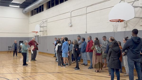
At the June 2025 presentation, a resident asked whether the Town had estimated the project’s economic return through increased business activity, commercial development or higher property values. Cardozo replied that no formal projection had been completed, explaining that the Town was working with organizations including the Connecticut Main Street Center to better understand how improvements might support business development.
By the July 2026 presentation, Cardozo drew a clearer distinction between the connectivity project and the Town’s future economic development efforts. “This is really about the infrastructure,” he explained, describing sidewalks, trails, lighting, traffic calming and streetscape improvements as laying the foundation for a subsequent “placemaking” initiative intended to focus more directly on attracting businesses and encouraging investment in the district.
That distinction helps explain both the purpose and the limitation of the current project. The connectivity improvements may create conditions that encourage future commercial investment, but they do not themselves include measurable business recruitment goals, estimates of future private investment or projections for expanding the commercial share of the Grand List.
Public comments changed the design
A September 2025 summary prepared for the Ad Hoc 2030 Task Force documented how SLR Consulting intended to evaluate comments received during the June 2025 public meeting as the project advanced to the 60 percent design phase, several of which later appeared in the updated plans presented in July 2026.
Comparing the two presentations shows several places where public input directly influenced the plans. The updated design now includes additional sidewalk connections on June Street and Bank Street to better connect Selden Plaza with the rest of the business district.
It also adds a new mid-block crossing on Bradley Road equipped with rectangular rapid flashing beacons to improve access between Coachman Square, the assisted living community on Bradley Road, and the shopping plaza across the street. That crossing responds directly to concerns raised during the 2025 meeting, when participants noted that some Coachman Square residents were unable to safely cross Bradley Road to reach nearby businesses. At the time, engineers agreed to study the possibility. One year later, the crossing has been incorporated into the design.
While the updated design addressed the long-standing request for a crossing by Coachman Square, the July 2026 discussion surfaced a new pedestrian safety concern. Residents of the recently completed Toll Brothers development on Bradley Road asked the Town to consider an additional mid-block crossing near Heritage Lane and Hillcrest Drive, noting that the development spans both sides of Bradley Road, requiring many residents to cross the roadway to reach the mailboxes, clubhouse and pool. Town officials agreed to continue evaluating additional crossing opportunities while cautioning that adding too many closely spaced crossings could create their own safety concerns.
Designers also modified landscaping and lighting near the hardware store on the corner of Amity Road and Landin Street after business owners expressed concern about accommodating large delivery trucks. During the latest meeting, additional questions were raised about whether the proposed asphalt trail could withstand regular tractor-trailer traffic there. DeStefano said the pavement could be strengthened at that location if necessary.
Officials are also evaluating whether portions of the proposed ten-foot-wide multi-use trail could be narrowed to eight feet in areas where space is constrained by trees, utilities or adjacent development.
Traffic signal remains a point of contention
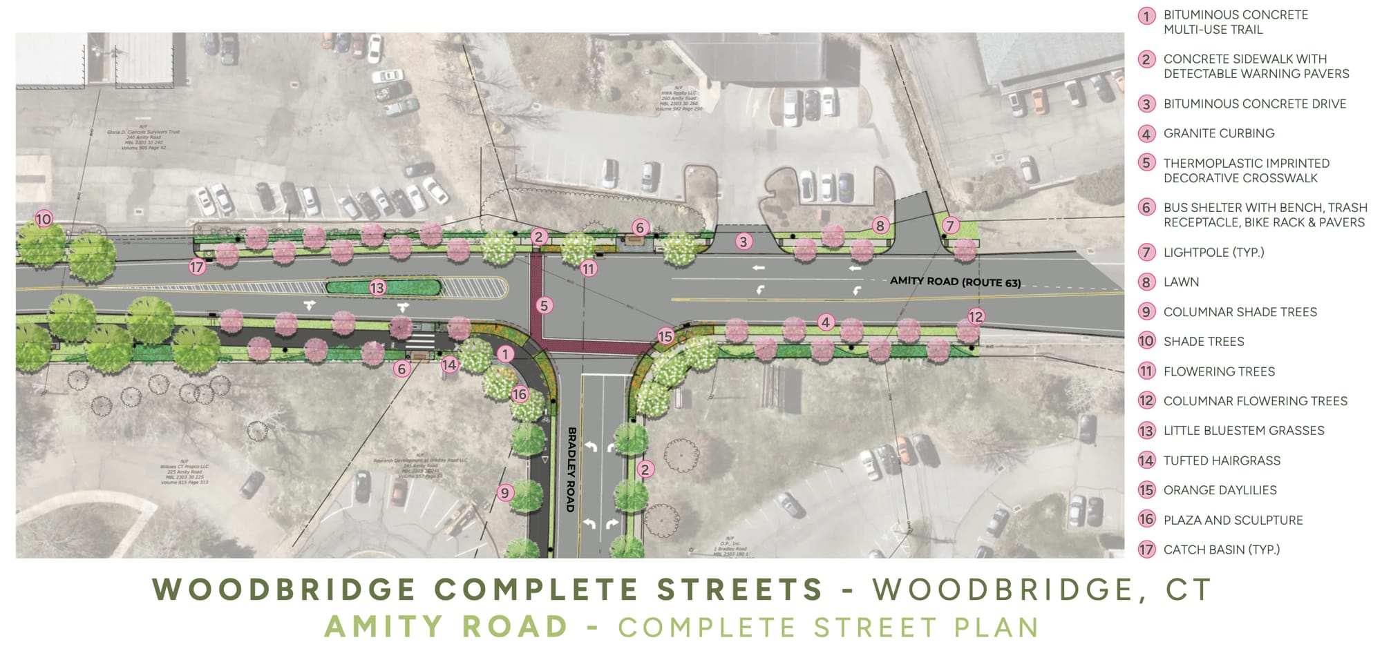
Perhaps the most significant unresolved issue remains the intersection of Bradley Road and Amity Road. Residents and business owners again urged the Town to install a traffic signal, citing vehicle crashes, congestion and difficulties entering Amity Road.
Town officials said both Woodbridge and its consultants concluded that a traffic signal would improve safety. The Connecticut DOT disagreed. Cardozo said the Town has repeatedly appealed that decision — including discussions with the DOT commissioner — but the state has declined to approve a signal as part of the project.
Instead, the current design relies on lane reconfiguration, landscaped medians, pedestrian-activated flashing beacons and traffic-calming measures. Cardozo said the Town nevertheless intends to continue pursuing a traffic signal in the future, even if it cannot be included in the current project.
Safety and long-term maintenance discussions
As the project has progressed, public discussion has shifted from broad support for improved walkability toward questions about how specific design features will function. Residents questioned whether pedestrians and increasingly common electric bicycles can safely share a single multi-use trail.
Others asked whether reducing portions of Amity Road to a single travel lane could worsen congestion, particularly when buses stop to load or unload passengers. DeStefano acknowledged that the project may not reduce traffic congestion and could modestly increase travel times in some situations, but said the primary objective is improving safety rather than increasing vehicle capacity.
One recurring topic at both meetings involved responsibility for maintaining the completed project. Although the state grant would fund construction, the Town will assume responsibility for maintaining pedestrian lighting, landscaping, street trees, bus shelters and other amenities located within the state highway corridor.
Officials said they intend to select low-maintenance landscaping while continuing the existing policy requiring adjacent property owners to clear sidewalks. No estimate was presented, however, for the annual municipal cost of maintaining the expanded infrastructure once construction is complete. How much those ongoing obligations will cost taxpayers annually remains an open question.
Next steps
Although the public presentations on the 30 percent and 60 percent designs occurred thirteen months apart, the project must still advance through 90 percent and final design before construction can begin, with each stage requiring review by the Connecticut DOT. The July presentation did not establish a revised timeline for completing the remaining design work and DOT reviews or indicate when construction is expected to begin.
As the connectivity project moves toward completion, the focus will increasingly shift from building the infrastructure foundation to broader economic development efforts — including placemaking, business recruitment and redevelopment initiatives — following the Cardozo administration’s decision earlier this year to dissolve the 2030 Task Force and transition its long-term economic development responsibilities to the Economic Development Commission.
Ultimately, the long-term return on the more than $8 million public investment will depend not only on what is built, but also on whether those improvements attract new businesses, encourage private investment, expand Woodbridge’s commercial tax base and, over time, shift a greater share of the property tax burden from homeowners to commercial taxpayers.
Watch the recordings
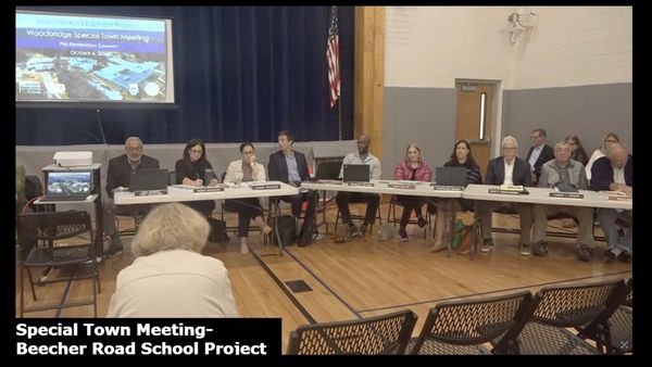
The complete video recordings of both public presentations are available on the Town’s YouTube channel, WGATV79 and can be viewed by clicking the embedded files below. The July 29, 2026 recording, below, provides the latest update on the project.
For comparison, the June 16, 2025 recording, below, describes the project at the 30 percent design stage and illustrates how the proposal and public discussion have evolved over the past thirteen months.